
Water And Ice Safety: read this before you go
Park in Auburn & the Foothills.
Read this first: the rules, fines, fees and hours on this page come from the sources linked next to them, and the date we read each one is not confirmed on this page. This is not legal advice. They can change, so check the current rule with the town, county, park or agency named before you rely on it. Anything not shown here is not confirmed: ask that town or park.
- 25 minDrive from Roseville (estimate)
- 45 minDrive from Sacramento (estimate)
- See feesEntry or day-use fee
- 19Named trails on this page

About Auburn State Recreation Area
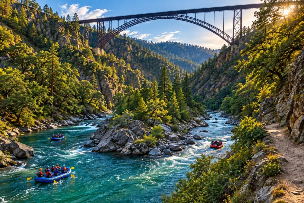
A long canyon park on the North and Middle Forks of the American River near Auburn, with trails for hikers, riders and mountain bikers, whitewater, fishing and the Confluence trailhead.
Plan Your Visit
- Hours
- Day use sunrise to sunset; Mammoth Bar, China Bar and Lower Lake Clementine 8 a.m. to sunset; Upper Lake Clementine 8 a.m. to 6:30 p.m. Auburn Sector office 8 a.m. to 4 p.m. daily except holidays (as of 2026-10-29).
- Season
- Seasonal gate closures October 15 to April 15 for Upper Lake Clementine Road, Drivers Flat Road, Sliger Mine Road and the Lower Lake Clementine boat ramp (Order 690-052-2026).
- Fees
- Vehicle Day Use: $10.00 (special rates may apply for peak season, holidays and weekends; subject to change).
- Parking
- Roadside parking at the Confluence, often very crowded on summer weekends; small lot at the Quarry Trail; limited parking at Maidu Drive; large lot with horse-trailer room at the Knickerbocker/Cool trailhead.
- Dogs
- Dogs allowed except at Lake Clementine. Leash no longer than six feet.
- Restrooms
- Restrooms are listed as a park facility; no potable water in the park, bring your own.
- Accessibility
- State Parks lists an accessibility page for the park; details not confirmed; check with State Parks.
- Bikes
- Traditional bikes, mountain bikes and Class 1 e-bikes only on posted trails listed below. Class 2 and 3 e-bikes are not allowed on any trail. Speed limit 15 mph on trails, 5 mph when passing hikers or horses or at blind turns.
- Swimming
- Swimming is prohibited at the Lake Clementine dam, boat launch and marina areas. State Parks lists swimming and beach areas at the park; no general river-swim rule was read.
- Boating
- Only non-powered boats (canoes, kayaks, rafts) on the rivers and streams, except Lower Lake Clementine.
- Camping
- Tent, remote and boat-in camping are listed. Lake Clementine boat-in camp, Ruck-A-Chucky and Mineral Bar campgrounds are named on the park page.
- Reservations
- Upper Lake Clementine day-use parking reservations (see the Lake Clementine page). Campground reservations through ReserveCalifornia.
- Getting There
- About 25 minutes and 18 miles by car from downtown Roseville (estimate, no traffic). Address as published: 501 El Dorado Street, Auburn, CA 95603.
Not published on the pages we read: kids and strollers. Ask the operator before you go.
Good to Know
- California State Parks runs the park under a Managing Partnership Agreement with the US Bureau of Reclamation; most of the land is federal. [1]
- The park page says it covers 40 miles of the North and Middle Forks of the American River, with over 900,000 visitors a year. [1]
- The Confluence, where the North and Middle Forks meet at Highway 49 and Old Foresthill Road, is the main trailhead for hiking and mountain biking; roadside parking only. [2]
- Vehicle day use is $10.00; the park accepts California Explorer, Golden Poppy and OHV day-use passes among others. [1]
- Only these routes are open to bikes, Class 1 e-bikes, horses or off-highway vehicles; every other trail is hikers only (Order 690-054-2026, January 5, 2026). [3]
- Class 2 and Class 3 e-bikes are prohibited on all trails; all e-bike classes are allowed on roads open to vehicles. [3]
- Speed limit for bikes is 15 mph; 5 mph when passing hikers or horses or approaching a blind turn. [3]
- The Western States Trail is hike and horse only (no bikes). The park page says it runs 100 miles from Lake Tahoe to Auburn, with over 20 miles in the park. [2]
- The Bridgeview Trail has views of the Foresthill Bridge, which the park page calls California's highest. [2]
- The Quarry Trail follows an old Gold Rush flume route and part of the former Mountain Quarries railroad; the 5.6-mile trail runs from Highway 49 to Poverty Bar. [2]
- Over 30 licensed outfitters run whitewater trips on the two forks (Class II to V). [1]
- Fire restrictions in effect since May 26, 2026 until further notice: no campfires, no portable cooking devices fueled by wood, gas, charcoal or liquid fuel, no tiki torches, with exceptions in designated campsites. [6]
- There is no potable water in the park; the park page warns of steep canyons, summer heat, ticks, poison oak, rattlesnakes, mountain lions and black bears. [1]
- Mammoth Bar OHV Area is part of the park and is open to off-highway vehicles only on set ride days (Tue, Wed, Fri, Sat; the motocross track fewer days); it closes after heavy rain and has chemical toilets but no running water. [7]
- Gold panning is allowed by hand and pan only, with a 15-pound per person per day limit on mineral material. [1]
Trails
Trail names, lengths and allowed uses exactly as the operator publishes them. Trail use can change after storms and fires; check the official trail page before you ride or hike.
| Trail | Miles | Allowed Use | Notes |
|---|---|---|---|
| Confluence Trail | 1.8 | hike, bike (Class 1 e-bike) | Single track from Old Foresthill Rd at the Confluence to Mammoth Bar Rd; slow to 5 mph at blind curves. |
| Stagecoach Trail (Upper and Lower) | 1.8 | hike, horse, bike (Class 1 e-bike) | Built as a stagecoach line in 1852; connects the Confluence to Russel Rd. |
| Western States Trail | over 20 miles in the park | hike, horse | No bikes. Runs 100 miles from Lake Tahoe to Auburn. |
| Quarry Trail (Hwy 49 to Poverty Bar) | 5.6 | hike, horse, bike (Class 1 e-bike) | Wide, level, easy; old flume and railroad route. |
| Culvert Trail | 1.2 | hike, bike (Class 1 e-bike) | Out and back from the Fuel Break Trail to Old Foresthill Rd. |
| Lake Clementine Trail | 1.8 | hike, bike (Class 1 e-bike) | Easy out and back from the Confluence to Lake Clementine Rd. |
| Lake Clementine Access Trail (Doc Gordon's) | 1.4 | hike, horse, bike (Class 1 e-bike) | Reaches Lake Clementine above the North Fork Dam. |
| Foresthill Divide Loop Trail | 10.6 | hike, horse, bike (Class 1 e-bike) | Loop with views of Lake Clementine and both forks. |
| Olmstead Loop Trail | 8.8 (trailhead text says 10) | hike, horse, bike (Class 1 e-bike) | Near the town of Cool, east of Highway 49. |
| Robie Point Firebreak Trail | 3.6 | hike, horse, bike (Class 1 e-bike) | Trailhead on Hwy 49, half a mile south of Auburn, behind Murphy's Gate; merges with the Western States Trail at 0.5 mile. |
| Bridgeview Trail | 0.8 | hike, horse, bike (Class 1 e-bike) | Views of the Foresthill Bridge; connects to Stagecoach and Mossy Rock trails. |
| Mossy Rock Trail | 0.7 | hike, bike (Class 1 e-bike) | Connects to the Bridgeview Trail. |
| Flood Road Trail | 0.3 | hike, bike (Class 1 e-bike) | Connector to Mossy Rock, Stagecoach and Upper Stagecoach. |
| Fuel Break Trail | 1.5 | hike, bike (Class 1 e-bike) | Wide, easy; starts off Foresthill Rd east of the Foresthill Bridge. |
| Manzanita Trail | 1.3 | hike, bike (Class 1 e-bike) | Narrow and winding; moderate to difficult. |
| McKeon-Ponderosa Trail | 2.6 | hike, horse, bike (Class 1 e-bike) | Steep closed dirt road from Driver's Flat Rd to McKeon-Ponderosa Way. |
| PG&E Road Trail | 1.3 | hike, bike (Class 1 e-bike) | Best reached from the Quarry Trail; no parking at the upper end. |
| Pointed Rocks Fire Break Trail (Training Hill) | not published | hike, horse | Hike and horse only per the use order; miles not printed. |
| Other hike-only trails (order lists them as hiking only) | not published | hike | Codfish Falls, Indian Creek, Pennyweight, Riverview, Tinker's Cutoff, Windy Point. |
Map
Planning a day here? Read our Mountain Biking Around Auburn.
Coming Up Around Auburn & The Foothills
Nothing at Auburn State Recreation Area itself is on our calendar right now, so here are the next dates in this area.
16th Annual Walk to Stock the Food Closet
Thu, Nov 26 · 9:00 AM-10:30 AM
Central Square, Auburn · Auburn & The Foothills
Thanksgiving morning 3.2-mile walk for the Interfaith Food Closet. Price: See event page
Checked Nov 16 on the organizer’s pageOfficial event siteAdd to Calendar
GoogleApple (.ics)Outlook 365Outlook.com
Auburn Christmas Tree Lighting
Sat, Nov 28 · 3:30 PM-7:00 PM
Downtown Auburn Central Square · Auburn & The Foothills
Live music in Central Square; Santa arrives at 5:30 p.m. to light the tree. Price: See event page
Checked Nov 16 on the organizer’s pageOfficial event siteAdd to Calendar
GoogleApple (.ics)Outlook 365Outlook.com
Placer Grown Farmers Market (Old Town Auburn)
Sat, Nov 28 · 8:00 AM-12:00 PM
Old Town Courthouse Parking Lot, Auburn-Folsom Rd at Lincoln Way · Auburn & The Foothills
Placer Grown farmers market in Old Town. Price: See event page
Checked Nov 16 on the organizer’s pageOfficial event siteAdd to Calendar
GoogleApple (.ics)Outlook 365Outlook.com
Cinema at the State: Solo Mio
Thu, Dec 3 · Doors 6:00 PM; film 7:00 PM
Odd Fellows Lodge #7, 1226 1/2 Lincoln Way · Auburn & The Foothills
A film about a groom stranded in Rome after a wedding disaster, shown by the Auburn State Theatre. Price: $15 adults; $12 seniors and kids under 12 (fees included)
Checked Nov 9 on the organizer’s pageOfficial event siteAdd to Calendar
GoogleApple (.ics)Outlook 365Outlook.com
Ken Ludwig's 'Twas the Night Before Christmas
Dec 4-20 · Thu-Fri 7:00 PM; Sat-Sun 2:00 PM (no show Dec 5)
General Gomez Art Center, 808 Lincoln Way · Auburn & The Foothills
Placer Community Theater family holiday play, all ages welcome. Price: See event page
Checked Nov 9 on the organizer’s pageOfficial event siteAdd to Calendar
GoogleApple (.ics)Outlook 365Outlook.com
More in Auburn & The Foothills
- Lake Clementine
- Olmstead Loop Trail
- Old Town Auburn
- Auburn Bike Park
- All of Auburn & the Foothills
- All Places
What is on near here: see upcoming events in Auburn & the Foothills or the full events calendar.
Questions People Ask
Is there a fee to visit Auburn State Recreation Area?
Vehicle Day Use: $10.00 (special rates may apply for peak season, holidays and weekends; subject to change)..
Are dogs allowed at Auburn State Recreation Area?
Dogs allowed except at Lake Clementine. Leash no longer than six feet.
What are the hours at Auburn State Recreation Area?
Day use sunrise to sunset; Mammoth Bar, China Bar and Lower Lake Clementine 8 a.m. to sunset; Upper Lake Clementine 8 a.m. to 6:30 p.m. Auburn Sector office 8 a.m. to 4 p.m. daily except holidays (as of 2026-10-29).
How far is Auburn State Recreation Area from Roseville?
About 25 minutes and 18 miles by car from downtown Roseville, without traffic (our estimate from OpenStreetMap routing).
Can you ride bikes at Auburn State Recreation Area?
Traditional bikes, mountain bikes and Class 1 e-bikes only on posted trails listed below. Class 2 and 3 e-bikes are not allowed on any trail. Speed limit 15 mph on trails, 5 mph when passing hikers or horses or at blind turns.
Sources
Facts checked October 29, 2026.
- Auburn State Recreation Area (California State Parks) (checked 2026-10-29)
- Auburn SRA Trails (California State Parks) (checked 2026-10-29)
- Order 690-054-2026 Trail Use Policy, Auburn Sector (PDF) (checked 2026-10-29)
- Order 690-048-2026 Water Safety, Auburn Sector (PDF) (checked 2026-10-29)
- Order 690-052-2026 Hours of Operation and Seasonal Closures (PDF) (checked 2026-10-29)
- Order 690-057-2026 Fire Restrictions, Auburn SRA (PDF) (checked 2026-10-29)
- Mammoth Bar OHV Area (California State Parks) (checked 2026-10-29)
- Lake Clementine (California State Parks) (checked 2026-10-29)
Cite this page: “Auburn State Recreation Area,” It’s Roseville, https://itsroseville.com/places/auburn-state-recreation-area/ (checked October 29, 2026).