
 Skip to Content
Roseville sits on I-80, about 19 miles by road from Old Sacramento by our routing. Most visitors drive in; Sacramento International Airport is the nearest airport, and the Roseville station at 201 Pacific Street, a five-minute walk from downtown, has one Capitol Corridor train each way a day plus Amtrak connecting buses. Here is how each option works, from the operators’ own pages.
- 1Capitol Corridor train each way a day at Roseville
- 5 minwalk from the station to downtown (0.2 mi, operator’s figure)
- 37 minSMF airport to Old Town by road, no traffic (our estimate)
- Freestation parking, city-owned lot, no permit
By Train

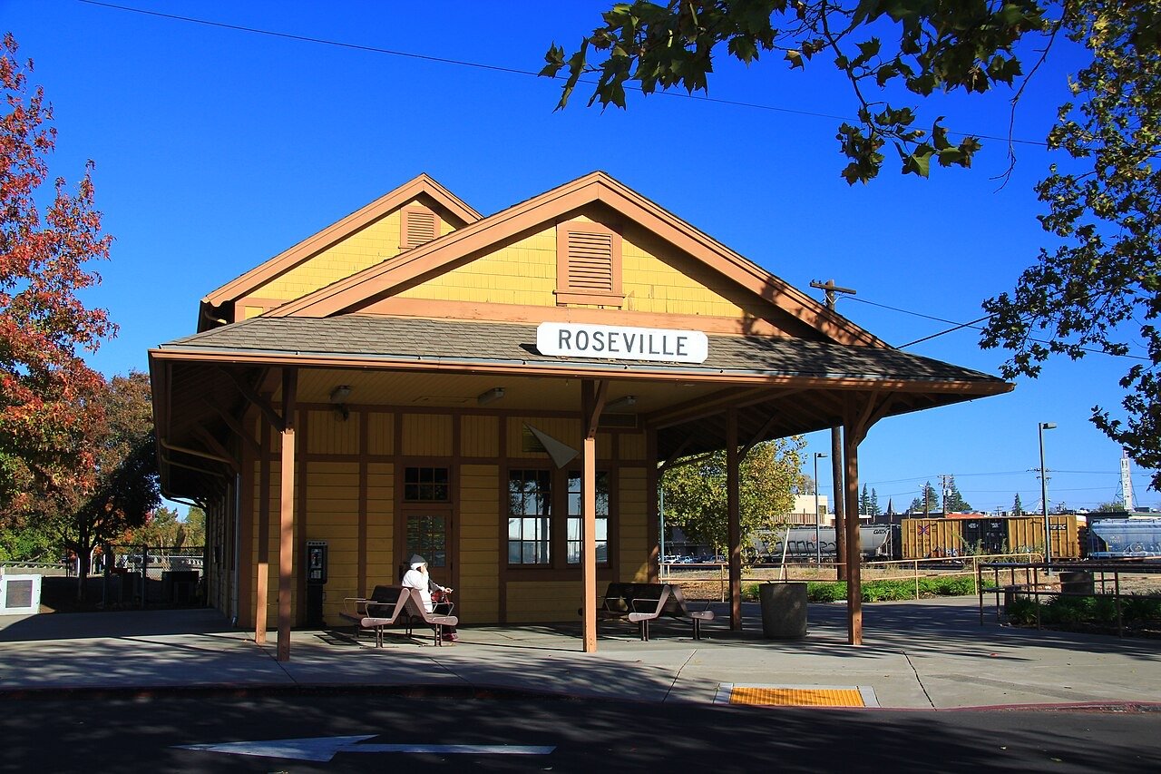
The Roseville station (Amtrak code RSV) is at 201 Pacific Street, a five-minute walk from downtown. Amtrak describes it as a platform with a shelter, opened in 1995, and Capitol Corridor lists it as unstaffed with one ticket kiosk. Capitol Corridor, the Sacramento to Bay Area line, reaches Roseville with only one train in each direction a day; every other Roseville time on its schedule is an Amtrak connecting bus. Amtrak Thruway Route 20 buses run Sacramento, Roseville, Rocklin, Auburn, Truckee and Reno. Capitol Corridor says a government ID is required to board its trains and connecting buses.
| Service | At Roseville | Good to Know |
|---|---|---|
| Capitol Corridor, weekdays | Train 529 leaves Roseville 7:09 a.m. toward Sacramento and the Bay Area; train 538 arrives 6:28 p.m. | Schedule effective December 8, 2025, as printed on capitolcorridor.org |
| Capitol Corridor, weekends and holidays | Train 729 leaves 8:23 a.m.; train 744 arrives 8:23 p.m. | Other Roseville times are connecting buses |
| Amtrak Thruway Route 20 | Buses to Sacramento, Rocklin, Auburn, Truckee and Reno | Book through Amtrak or Capitol Corridor |
| California Zephyr | Listed by Capitol Corridor as a connection at or near the station | Times not printed on the pages we read |
Parking at The Station
Free
City of Roseville lot: 74 regular spaces, 12 short-term (2-hour limit) and 4 accessible spaces, free, no permit, no time restriction on the lot. More parking on the street and in the Pacific Street lot.
Capitol Corridor station pageBikes
Five rack spaces and four BikeLink eLockers, plus outside seating.
Capitol Corridor station pageWalk From The Platform
Operator figures
Downtown Roseville 5 minutes (0.2 mi), Carnegie Library Museum 10 minutes (0.3 mi), Placer County Fairgrounds 15 minutes (0.7 mi), Miners Ravine Trail 15 minutes (0.5 mi).
Capitol Corridor station page
By Car
Interstate 80 runs through Roseville between Sacramento and Auburn, and State Route 65 branches north toward Rocklin and Lincoln. Old Town and the station sit just west of I-80. For closures and chain controls over the Sierra, use Caltrans: QuickMap for a live map, or the road-conditions line 1-800-427-7623 (roads.dot.ca.gov). The regional 511 site now forwards to NorCal GO (norcalgo.org).
By Air
The nearest airport is Sacramento International Airport (SMF), 6900 Airport Boulevard, Sacramento (flysmf.gov). By our own routing on OpenStreetMap data, it is about 23 miles and 37 minutes by road to Old Town Roseville without traffic; allow more at rush hour. Shuttles and buses are not confirmed here, so check with the airport directly.
Getting Around
Roseville Transit
City of Roseville
City-run Local, Commuter, Rapid Link, Game Day Express, Arrow on-demand and Paratransit service, with trip planning and real-time tracking. Fares are on the city’s fares page.
roseville.ca.gov transitLight Rail to Sacramento
SacRT light rail does not run into Roseville. Roseville Transit Local meets SacRT at the Louis/Orlando Transit Center near the county line, and Rapid Link meets it at the Watt/I-80 light rail station. SacRT: (916) 321-2877.
Other transit providers (City of Roseville)Placer County Transit
Serves south Placer County outside Roseville and connects at Louis/Orlando and the Galleria transfer point. Fixed route and Dial-A-Ride: (916) or (530) 745-7560; commuter: (916) 784-6177.
Other transit providers
Where to Start
Start in Old Town and the Vernon Street Town Square, a short walk from the station. City Hall is at 311 Vernon Street. From there, the Railroad Day Trip covers the Carnegie Museum and the rail story, Folsom Lake and Mountain Biking Around Auburn cover the outdoors, and the Itineraries lay out whole days with road times.
Day Trips
Sacramento
Day trip
About 27 minutes by road from Old Town to the California State Railroad Museum (our routing, no traffic). Outside our five areas, so we mark it as a day trip.
Rails to Sacramento itineraryTruckee and Donner Summit
Outside the hour
About 98 minutes up I-80 to Donner Memorial State Park (our routing, no traffic, no winter chain controls). Outside the hour.
Truckee and Donner itinerary
Questions People Ask
Does Amtrak stop in Roseville?
Yes. The Roseville station at 201 Pacific Street has one Capitol Corridor train each way a day, plus Amtrak connecting buses. Capitol Corridor lists the California Zephyr as a connection there.
What is the closest airport to Roseville?
Sacramento International Airport (SMF), about 23 miles and 37 minutes by road without traffic, by our routing.
Is parking free at the Roseville train station?
Yes. Capitol Corridor says the city-owned lot is free with no permit, with 74 regular, 12 two-hour and 4 accessible spaces.
Can I take light rail from Sacramento to Roseville?
Not directly. Light rail stops short of Roseville; Roseville Transit buses meet it at Louis/Orlando and at Watt/I-80.
More Guides
Sources
Facts checked October 29, 2026.
- Capitol Corridor, Roseville station, checked October 29, 2026: https://www.capitolcorridor.org/stations/roseville/
- Capitol Corridor schedules, checked October 29, 2026: https://www.capitolcorridor.org/schedules/
- Amtrak, Roseville station (RSV), checked October 29, 2026: https://www.amtrak.com/stations/rsv
- Sacramento International Airport, contact, checked October 29, 2026: https://flysmf.gov/contact
- City of Roseville, Transit, checked October 29, 2026: https://www.roseville.ca.gov/public_works/transit/index.php
- City of Roseville, other transit providers, checked October 29, 2026: https://www.roseville.ca.gov/public_works/transit/services_schedules/other_transit_providers.php
- Caltrans road conditions, checked October 29, 2026: https://roads.dot.ca.gov/
- Caltrans QuickMap, checked October 29, 2026https://quickmap.dot.ca.gov/
- OSRM routing on OpenStreetMap data (our road times), checked October 29, 2026: https://project-osrm.org/
Cite this page: It’s Roseville, “Plan a Visit to Roseville,” https://itsroseville.com/visit/, checked October 29, 2026.